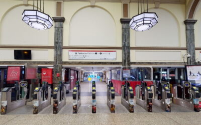
Mixed Reality Indoor wayfinding and discovery
BriteWay integrates both AR and VR with Blue Dot navigation for advanced indoor wayfinding and discovery.
Use it as a standalone app or integrated in your app to bring precise location accuracy together with high definition mixed reality (XR) guidance to help visitors plan and navigate your destinations with ease.
Send download link to:Brochure Indoor Mapping
Send download link to:Transport for Wales Case Study

Visual indoor navigation with Augmented Reality

Smarter journey planning with Virtual Tours

Maintain Digital Twin assets

Increase footfall and sales with Insights
")
Improve operational efficiency with Forecasts
What is augmented reality indoor navigation?
Why use augmented reality indoor navigation?
Who is using augmented reality indoor navigation?
Where is augmented reality indoor navigation being used?
Related articles

Briteyellow Secures Funding From DAI For Innovative Indoor Wayfinding App
We are delighted to share that Briteyellow has secured funding from the Design Age Institute (DAI) at the Royal College of Art for developing an innovative app as part of the Transport & Mobility Pathfinder Innovation Programme, supported by UK Research and...

Briteyellow Creates AR Maps For TfW To Make Rail Travel Easy For Passengers
We have all lost our way while looking for something at railway stations at some point - Especially if you are visiting one for the first time or have trouble navigating due to a mobility issue. Although convenient and enjoyable, rail journeys are often considered...
Augmented reality maps launched to help passengers feel more confident using the rail network for Transport for Wales
Briteyellow created a solution for Transport for Wales to improve communication about station facilities and availability to enable customers to find staff easily, whilst also helping to reduce stress for passengers and encourage self-service.